Gent – Dampoort
Ruimtelijke visie stationsomgeving van Dampoort in Gent

In het kader van een meervoudige studieopdracht werd gevraagd om een ruimtelijke visie op de gebied rondom station Dampoort in Gent. Deze opgave kende al langere tijd twee ogenschijnlijk moeilijk verenigbare doelen. Enerzijds de noodzaak om het functioneren van de complexe verkeersknoop te waarborgen en anderzijds de locatie tussen voorstad en centrum als verblijfsgebied en hoogwaardig openbaar vervoer knooppunt vorm te geven.

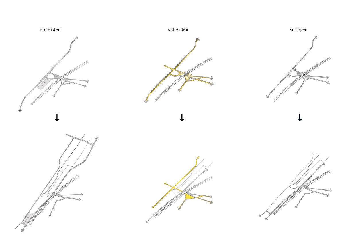
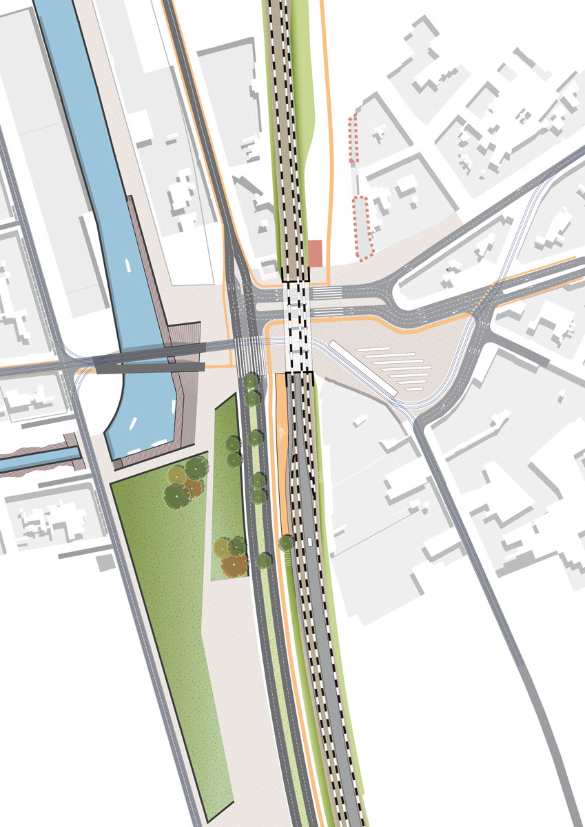
De planfiguur bestaat uit een raamwerk van openbare ruimten dat de huidige verkeersknoop Dampoort ontwart. Allereerst wordt de verkeersdruk gespreid door nieuwe aansluitingen voor te stellen. Vervolgens wordt de verbinding voor autoverkeer tussen de Dampoort en het stadscentrum uit het netwerk geknipt wat ruimte schept voor een hoogwaardige langzaam verkeersverbinding tussen stad en station.

Dit alles creëert de ruimte om het netwerk van openbaar vervoerlijnen ruimtelijk te scheiden van het wegverkeer en het openbaar vervoer knooppunt Dampoort (trein,

bus en tram) te optimaliseren.

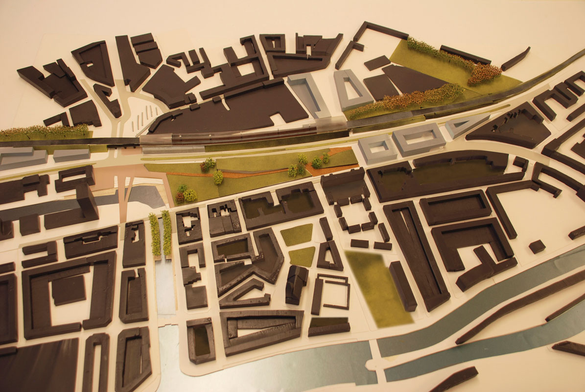
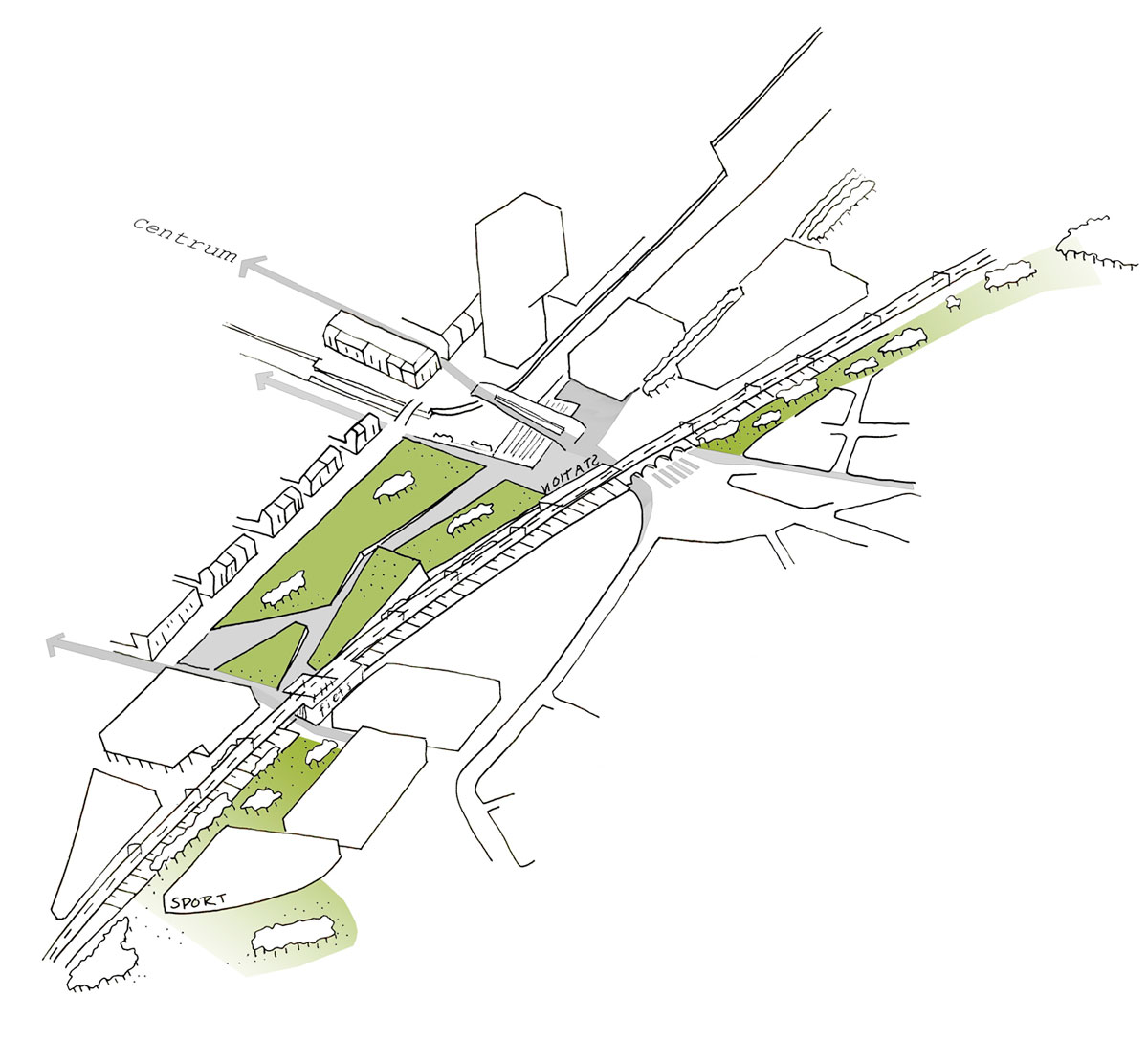
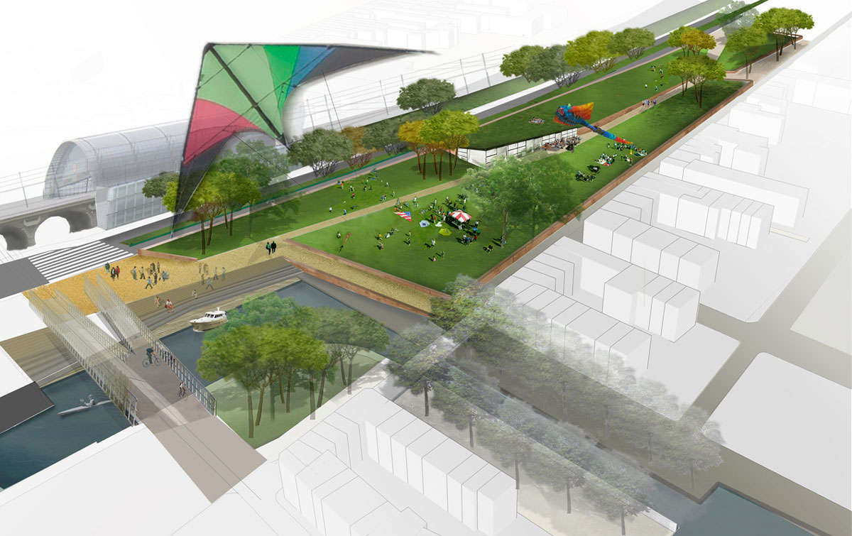
Het raamwerk kan in fases worden aangelegd en flankerende onroerend goed projecten kunnen onafhankelijk van de infrastructuur worden ontwikkeld. Centraal in het plangebied wordt een grote langgerekte publieke ruimte uitgespaard. Deze “lange leegte” creëert door diagonale zichtlijnen allereerst ruimte en maakt de te onderscheiden stadsdelen rondom de huidige Dampoortknoop zichtbaar aan elkaar.

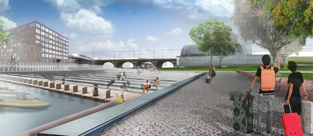
De nieuwe stedelijke ruimte tussen de Dampoortknoop en de nieuw toe te voegen zuidelijke onderdoorgang en stationstoegang maakt de positie van het station Dampoort als schakelerkeer ruimtelijk helder afleesbaar. De huidige Dampoortknoop wordt hiermee niet alleen functioneel ontward maar ook ruimtelijk ontspannen.



Gent – Dampoort
Spatial vision for the Dampoort station area in Gent.

A spatial vision for the area around the Dampoort station in Gent was requested within the framework of an invited competition. This assignment had two apparently hardly reconcilable aims. On the one hand, the necessity to ensure the functioning of the complex traffic intersection and, on the other hand, giving shape to the location between suburb and centre as an attractive area and a high-quality public transport interchange.

The plan comprises a framework of public spaces that unties the existing Dampoort traffic knot. First of all, new connections are to spread the volume of traffic. Secondly, the vehicle traffic connection between Dampoort and the city centre is cut out of the network, which provides space for a high-quality pedestrian and cycle connection between city and station.

All that makes room to spatially separate the network of public transport lines from the road traffic and to optimise the Dampoort public transport interchange (train, bus and tram).

The execution of the framework can be phased and ancillary development projects can be carried out independently from the infrastructure. A large elongated public space will be left open in the centre of the plan area. First and foremost, this ‘elongated emptiness’ introduces space into the area by means of diagonal sight lines and makes the individual neighbourhoods around the present Dampoort interchange visible to one another.

The new urban space between the Dampoort interchange together with the future southern underpass and the entrance to the station enhance the spatial clarity of the position of the Dampoort station as a pivot in the circulation structure. This not only functionally untangles the current Dampoort knot but also puts it spatially at ease.